This collaboration applies the latest earth observation data and techniques to map changes in land cover that are relevant to water-related management issues including flood and drought risk reduction, soil and water conservation, and forest protection and restoration.
On 15-17 July 2025, IUCN and Hatfield conducted a field visit to Song Ma District, Son La Province to evaluate the pilot remote sensing toolkit to monitor land cover change in steeply sloped areas, with an emphasis on detecting:
- Agricultural expansion
- Transition from annual to perennial crops and agroforestry
- Canopy cover recovery through natural regeneration or agroforestry development
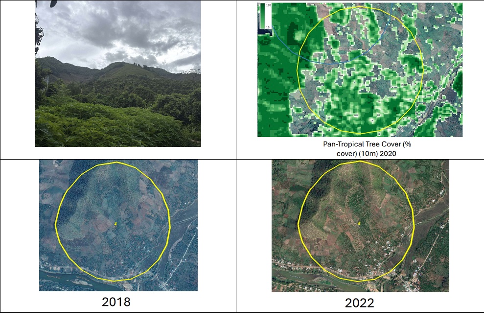
Prior to the field visit, the research team collected and processed satellite images from multiple sources, including: Land Cover and Forest Monitoring (LCFM), Copernicus Land Monitoring Service (2020), Tree Cover Disturbance Monitoring (TCDM-radar, 2017–2024), JRC Pan-tropical 10 m Tree Cover Density (2020).
19 pilot sites in Song Ma District, Son La Province © IUCN Viet Nam
These data were combined with analytical methods such as Seasonal Sen’s Slope and Spectral Recovery to assess vegetation trends and recovery, using indicators like deltaIR, R80P and Y2R in 19 demonstration sites in Song Ma District.
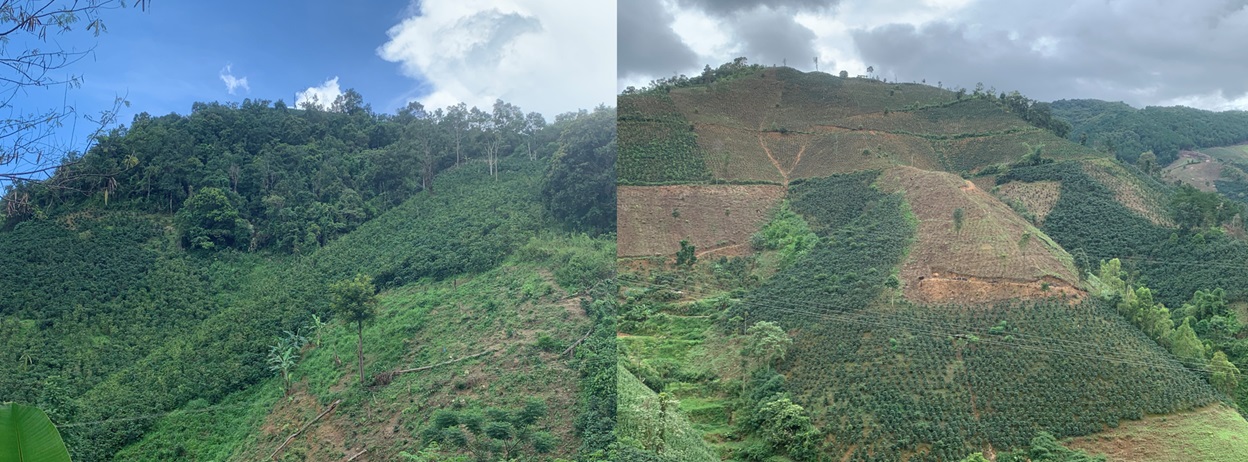
During the field trip, the team did on-site assessments and household interviews to verify land cover conditions, agricultural practices, and forest protection and restoration efforts. This helped align remote observations and field realities, and improved accuracy and reliability of the toolkit.
Ground true images at the field used to validate the remote sensing toolkit © IUCN Viet Nam
In addition, the team gathered insights into the drivers of land cover change in mountainous areas, including:
- Policy-induced agricultural transitions promoted by local authorities, encouraging a shift from annual crops to perennial crops and agroforestry systems.
- Continued cultivation of corn and cassava on steep hillsides immediately below remaining forest patches to meet local food and livestock feed demand.
- Persistence of traditional crop cultivation on slopes due to economic necessity by households that cannot adopt alternative agricultural practices, such as longan or coffee.
-
The causes of current forest loss may stem from both traditional agriculture (corn, cassava) and the shift to perennial crops (longan, coffee, fruit trees).
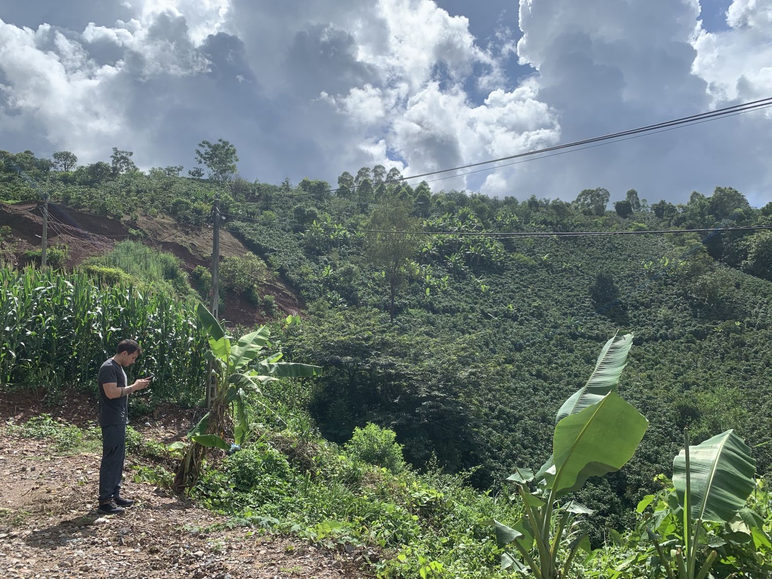
Coffee plantation replaced by corn or cassava on a steep slope, squeezing the forest in Song Ma District © IUCN Viet Nam
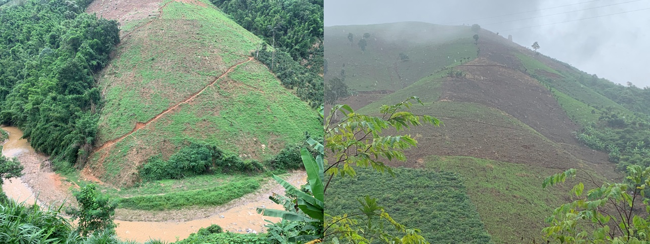
Forest clearing for corn and cassava on steep slopes poses a high risk of flash floods in Song Ma District © IUCN Viet Nam