Listen to this article
Estimated 5 minutes
The audio version of this article is generated by AI-based technology. Mispronunciations can occur. We are working with our partners to continually review and improve the results.
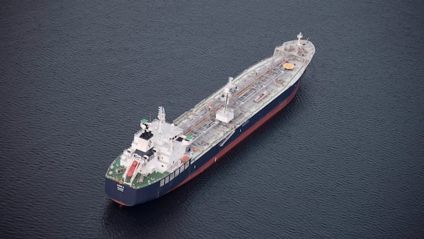
For years, oil tanker traffic has been prohibited off the waters of northern British Columbia in order to protect environmentally sensitive coastlines from disaster.
But the federal government is now open to the idea of changing its moratorium.
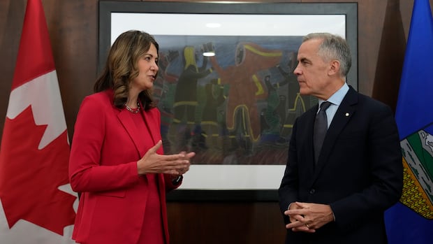
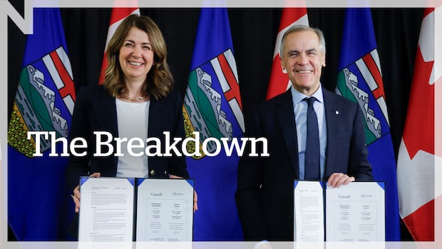
The debate over the future of the tanker ban arose from Prime Minister Mark Carney and Alberta Premier Danielle Smith signing a memorandum of understanding (MOU) in November that lays out the steps for a potential pipeline to carry oil from the Alberta to the Pacific coast.
Here’s what you need to know about the oil tanker moratorium and the area it’s meant to protect.
What is the ban on oil tanker traffic?
The federal government first imposed an oil tanker moratorium back in 1972 but it wasn’t legislated, as the Oil Tanker Moratorium Act, until 2019.
The ban covers an area that stretches from the northern tip off Vancouver Island to the B.C.-Alaska border.
The act prohibits oil tankers from stopping, loading or unloading in any port in the designated area.
It applies to vessels carrying a cargo of more than 12,500 metric tons of crude oil or persistent oil products, such as bitumen and Bunker C fuel, which dissipate slowly and can linger in the environment.
The moratorium does not apply to refined oil products, like gasoline, diesel and jet fuel, as well as liquefied natural gas (LNG).
Penalties for violating the Tanker Moratorium Act can include fines up to $5 million for each instance of non-compliance.
What’s the voluntary tanker exclusion zone?
The federal government established the voluntary tanker exclusion zone in the late 1980s. It offers a larger buffer zone between tankers and much of B.C.’s coast.
That boundary extends further off shore, about 100 km west of Haida Gwaii and roughly 40 km off Vancouver Island.
It’s aimed at U.S. tankers transporting oil between the Trans-Alaska Pipeline System marine terminal in Valdez, Alaska and refineries in Washington state.
“The size of the area was based on calculating the worst possible drift of a disabled tanker with a cargo, versus the time required for help to arrive,” Transport Canada explains on its website.
CBC News has confirmed that the federal government has agreed to possible exemptions to the tanker ban on B.C.’s northern coast as it discusses a new energy accord with Alberta.
How dangerous are the waters in moratorium area?
The Hecate Strait, famed for being treacherous, is often the focus of concerns about oil tanker traffic.
It separates Haida Gwaii from mainland B.C. and all types of boats, including fishing vessels, ferries and container ships, have run into problems in this stretch of water.
There is a “cocktail of risks” when it comes to navigating vessels in any area of open water, says Mariah McCooey, director of hydrography for the Pacific region of the Canadian Hydrographic Service (CHS) — a division of the science branch of the Department of Fisheries and Oceans that is tasked with supporting safe navigation.
But she explains that what makes the Hecate strait unique is that it’s particularly shallow, which contributes to big Pacific waves stacking up even higher.
How do ships navigate the area?
Mariners are what McCooey calls “risk-assessing machines,” who use all available data to steer ships.
Navigation charts for areas off Haida Gwaii and the north coast of B.C. have greatly improved in the past 10 years thanks to new technology and data collection, she said.
Prior to that, McCooey explains, charts relied on survey data that dated back to 1912 and measured manually.
She says CHS now has 50 updated charts, covering hundreds of kilometres of coastline, using high quality sensors capable of collecting thousands of data points at one time and giving a clearer picture of what lies beneath the surface of the waters off northern B.C.
Any vessel travelling in the Hecate Strait would also rely on the knowledge of a specialized pilot who is mandated to be on board and guide ships from ports out to sea.
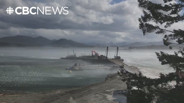
A potential new oil pipeline from Alberta to B.C. is shedding light on the dangerous B.C. waters that tankers would have to navigate if it’s built. CBC’s Janella Hamilton dives into the implications and the worries.
Who’s for and against the moratorium?
Those who want the tanker ban lifted or changed — including Alberta’s oil sector, Premier Smith and federal Conservative leader Pierre Poilievre — argue it hinders Alberta’s ability to export its oil to key markets in Asia.
Supporters of the moratorium, including First Nations and environmental groups, say the ban is vital to protecting environmentally sensitive coastal areas and critical marine ecosystem that are key to both the provincial economy and Indigenous ways of life.
“There is no technology that can clean up an oil spill at sea or in a salmon river,” Coastal First Nations said in a statement emailed to CBC News last month, calling the moratorium a “matter of national responsibility.”
B.C.’s NDP-led government also supports the moratorium, and in November, Premier David Eby signed a declaration, along with Coastal First Nations, urging Ottawa to keep the oil tanker ban in place.
The National’s At Issue panel breaks down Prime Minister Mark Carney and Alberta Premier Danielle Smith’s partnership to build a new pipeline out of Alberta and the political and environmental pushback it sparked.