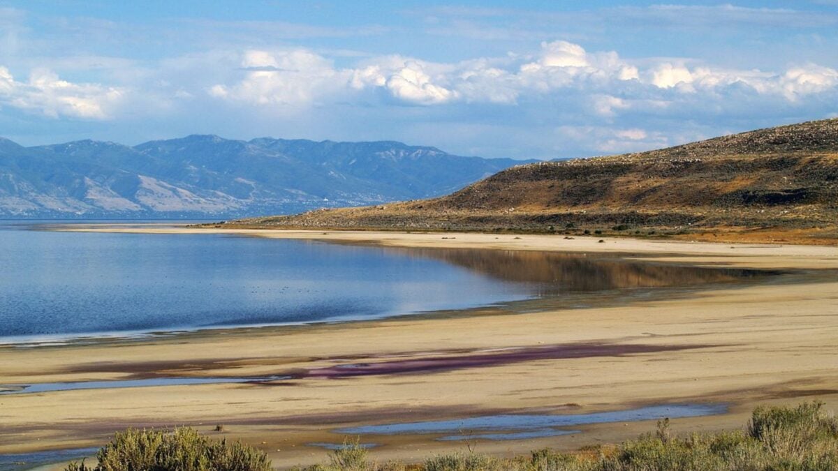
The Great Salt Lake once reached depths of up to 1,000 feet and spanned roughly 20,000 square miles, but today, it mostly resembles a parched wasteland. So, when signs of life suddenly began popping up across the drying playa, scientists were perplexed.
In the last several years, reed-covered mounds have appeared off the lake’s southeast shore. These densely vegetated oases must receive enough freshwater to sustain plant life, but experts weren’t sure where this resource was coming from. Researchers at the University of Utah are working to get to the bottom of this mystery, gradually uncovering a subsurface plumbing system that pumps fresh groundwater into the lake and its surrounding wetlands.
It appears to be “from a water resource that could be useful in the future, but we need to understand it and not overexploit it to the detriment of the wetlands,” co-researcher William Johnson, a professor of geology and geophysics at U of U, said in a university statement.
A worsening environmental crisis
Overexploitation has been one of the primary drivers of the Great Salt Lake’s decline, research shows. Humans have increasingly diverted freshwater from its feeder streams for agriculture and municipal use. As climate change has exacerbated evaporation in this Sun-baked region, the lake’s stressed tributaries have struggled to replenish rapid water loss.
If used responsibly, this potential new source of freshwater beneath the lakebed could help re-saturate lakebed crusts and reduce hazardous dust pollution blowing into nearby communities. With that goal in mind, Johnson and his colleagues have been using a suite of instruments and data—including piezometers, seepage meters, salinity profiles, and more—to locate underground freshwater deposits.
Probing beneath the surface
In February, he hired the Canadian firm Expert Geophysics to conduct aerial electromagnetic surveys over Farmington Bay, located on the lake’s southeastern shore. A helicopter with an airborne electromagnetic sensor hanging beneath it flew in a grid pattern over the bay, transmitting a frequency deep into the lakebed. A receiver then recorded the electromagnetic signals bounding back, gathering data that helps researchers locate freshwater deposits.
“It’ll give you a spectrum, basically, of magnetic fields, and we’ll use that data to create a 3D image of what’s under the earth,” Jeff Sanderson, a crew leader with Expert Geophysics, said in the U of U statement.
The wealth of data the researchers have gathered so far suggests a vast freshwater resource potentially extends thousands of feet beneath the cracked lakebed. It appears that immense pressure exerted on this aquifer allows water to rise up through the sediment, albeit very slowly. Thus, Johnson believes the mysterious mounds formed in places where this natural plumbing system delivers fresh groundwater to the surface.
The team has yet to publish its findings but presented preliminary data in July at the Geochemical Society’s 2025 Goldschmidt conference in the Czech Republic. Next, they will work to map this freshwater resource and determine its age and where it originated from. “The last thing I want to do is get this hyped as a water resource, but it’s very clear, and it’s under pressure,” Johnson said. “And in my mind, it could help mitigate any dust generation on the exposed playa.”