
How we located the aftermath of a strike in Zaporizhzhiapublished at 12:53 BST
Sherie Ryder
BBC Verify journalist
We’ve been looking at some posts on social media overnight from Zaporizhzhia, Ukraine, the front-line region where it’s been reported that Russian strikes hit several areas.
Ukraine’s President Volodymyr Zelensky posted images on X showing emergency services putting out fires. He said that 13 people had been wounded, including two children.
Close up night-time images are often tricky for us to verify, especially when buildings are burning, but daytime aftermath footage helps us to piece things together.
This morning, footage from a residential area revealed a missile had landed, causing windows to shatter on an adjacent block of flats.
As the person recording panned around, we were able to pinpoint residential blocks in Komunarskyi in Zaporizhzhia city by looking at satellite images on Google Maps.
On closer inspection, we could see that some of the blocks were joined by distinctive panelling, which we could also cross-reference using Yandex, another search tool. In addition, a low wall, about waist height was visible in the middle of the blocks, and the balconies matched up with StreetView. This helped us to find the exact location.
Finally, we carried out ‘reverse image searches’ by checking a few freeze frames to make sure the footage was from today, and not old.
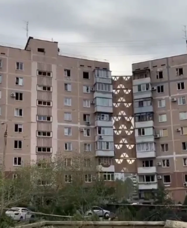 Image source, X