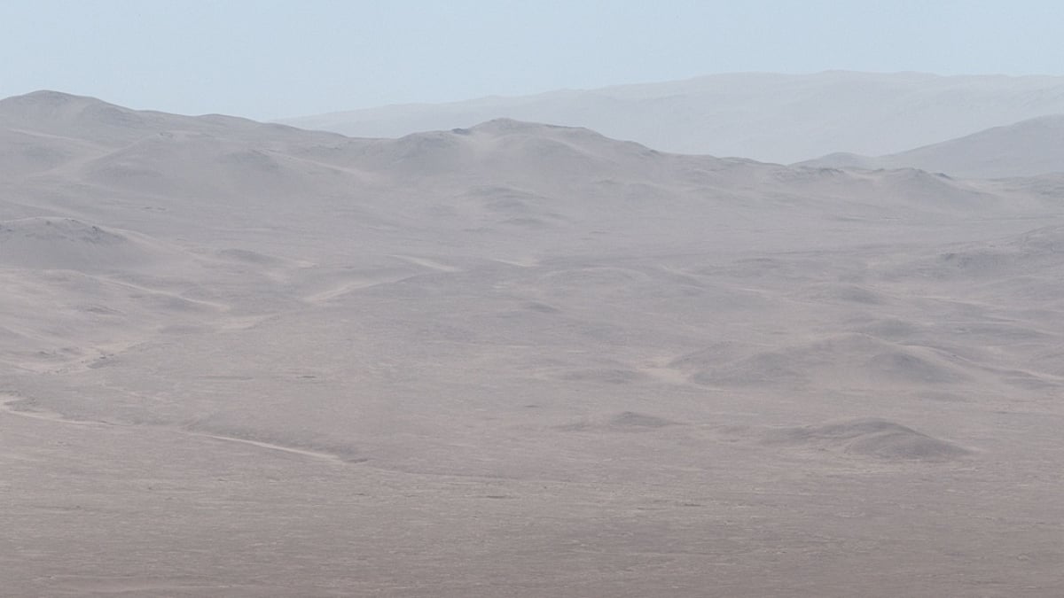
NASA‘s Curiosity rover took advantage of a clear winter day to snap new panoramic pictures of one of Mars‘ most enduring mysteries.
A lookout point in the foothills of Mount Sharp, a 3-mile-high mountain, allowed the rover to see all the way across Gale Crater‘s floor. Near the center of the image is Peace Vallis, an ancient river channel thought to have carried water into the crater billions of years ago.
Despite the two planets being separated in space by an average 140 million miles, Mars’ Peace Vallis is a valley system that closely resembles river drainage features on Earth. But scientists still don’t know how the alien landscape formed and where the water came from. Some think it could have been rain during an era when the Red Planet was warmer and wetter. Others think the water could have come from melted snow or underground springs.
The new images, taken from a distance of about 19 miles, reveal rocky formations and sediment patterns not seen before.
“While Curiosity has taken pictures of Peace Vallis in the past, this is the first time details like these have been seen within it,” NASA said.
A mission to a distant asteroid just got an unexpected surprise
The image at the top of this story is just one section of a larger panorama. Shown below, the full picture involved stitching together 44 individual frames, captured by Curiosity’s Mastcam instrument. Scientists adjusted the colors to show the scene as it would appear to people in Earth’s lighting conditions.
Mashable Light Speed
To make this wide panorama, NASA’s Mars Curiosity rover beamed back 44 frames to be stitched together on Earth.
Credit: NASA / JPL-Caltech / MSSS
The rover also used its ChemCam instrument, a black-and-white camera that functions like a small telescope, to study the distant features. The instrument captured Peace Vallis in 10 frames that were later stitched together to create the image below. The dark features just left of center are rock formations.
These new observations may help scientists figure out how sediment flowed into Gale Crater and for how long. Such photos can also offer clues about the original water source.
Before Mars turned into a chilly dust bowl, it once was home to rivers, lakes, and maybe even oceans. Over the years, scientists have found plenty of evidence that the planet wasn’t always arid, but it’s unclear when the water disappeared, why, and how long habitable conditions might have lingered.
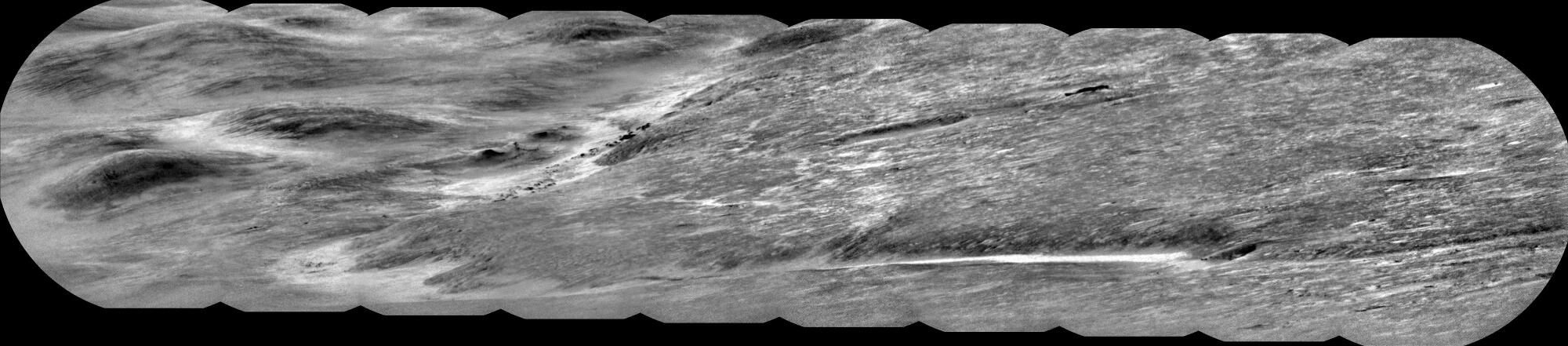
Scientists believe water and sediment once flowed down Peace Vallis into Gale Crater, spreading a fan of sediment across the basin floor.
Credit: NASA / JPL-Caltech / LANL / CNES / CNRS / IRAP / IAS / LPG
Since its mission launched in 2011, Curiosity, a Mini Cooper-sized lab on six wheels, has traveled about 352,000,022 miles: some 352 million flying through space and another 22 rambling over Martian terrain. Studying the crater’s water history is part of that mission to investigate where and how well Mars could have supported microbial life, if any formed there.
Some researchers are feeling more confident than ever that microorganisms did indeed exist on the Red Planet. NASA held a news conference last week about a rock sample collected by Curiosity’s younger sibling at Jezero Crater in 2024. The sample contains fossilized material that could have been created by ancient biological activity, according to the U.S. space agency, though officials caution that they can’t rule out other non-biological explanations.
“This finding by our incredible Perseverance rover is the closest we’ve actually come to discovering ancient life on Mars,” said Nicky Fox, NASA’s associate administrator.
Right now, about 2,000 miles away from Perseverance, Curiosity is exploring a mysterious Martian region that spans six to 12 miles. Called a boxwork, the landscape features a gridlike pattern of ridges. Scientists have suggested these ridges could have formed with the last trickles of water in the area before drying out for good. But mineral veins in the boxwork conflict with the timeline suspected for when groundwater vanished.