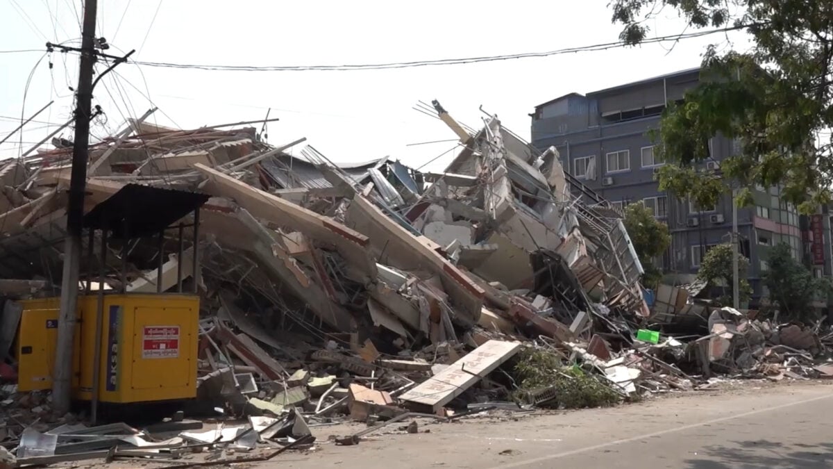
On March 28, Myanmar was rocked by a 7.8 magnitude earthquake that claimed over 5,000 lives and caused damage even in neighboring countries.
In a study published July 10 in The Seismic Record, seismologists confirmed previous research indicating that the southern part of the large earthquake’s rupture, or fracture, took place at astounding speeds of up to between 3.1 and 3.7 miles per second (5 to 6 kilometers per second)—at supershear velocity. This likely played a role in the earthquake’s devastating impact.
When an earthquake strikes, the first seismic waves to propagate from the epicenter are P waves, fast-moving waves that compress their way through all kinds of material but do not cause a lot of damage. Then come the S waves, or shear waves, which are slower but cause highly destructive perpendicular motion. Simply put, when parts of an earthquake’s fault rupture at supershear velocity, it means that the speed of the break along a particular stretch of the rupture was faster than the speed of its S waves. In moderate earthquakes, rupture velocities are usually between 50 and 85% of S-wave velocity.
Myanmar’s earthquake occurred along the Sagaing Fault, which runs north-south through Myanmar. The fault is strike-slip, meaning two tectonic plates slide horizontally against each other. The Sagaing Fault’s strike-slip movement in March was clearly captured in potentially first-of-its-kind footage showcasing an expanse of land suddenly moving forward relative to the viewer.
The natural disaster saw around 298.3 miles (480 km) of the Sagaing Fault rupture or “slip,” which is extremely long for a strike-slip rupture of this magnitude, according to the seismologists. By studying seismic and satellite imagery, they determined that the rupture had “large slip of up to 7 m [23 feet] extending ∼85 km [52.8 miles] north of the epicenter near Mandalay, with patchy slip of 1–6 m [3.3–19.7 feet] distributed along ∼395 km [245.4 miles] to the south, with about 2 m [6.6 ft] near the capital Nay Pyi Taw.”
A seismic station near Nay Pyi Taw registered ground motion data that were “immediately convincing of supershear rupture given the time between the weak, dilational P wave first arrival and the arrival of large shear offset of the fault” at the station, UC Santa Cruz’s Thorne Lay said in a Seismological Society of America statement. An offset is the ground displacement that occurs along a fault during an earthquake. “That was unusually clear and convincing evidence for supershear rupture relative to other long strike-slip events that I have worked on.”
Lay and his colleagues suggest that the supershear velocity, as well as the rupture’s strong directivity (the piling up of S waves in the direction of the fault line as the rupture spreads) toward the south, might have caused the earthquake’s widespread damage.
While the Sagaing Fault frequently causes large earthquakes, the one in March involved a stretch of the fault between the cities of Mandalay and Nay Pyi Taw that has been quiet since 1912. “Longer histories and better understanding of fault segmentation and geometry are needed to have any guidance for future event activity, but I would not expect the central area to fail again before a long period of rebuilding strain energy,” Lay added.
While it is impossible to predict earthquakes with any kind of precision, earthquake early-warning (EEW) systems provide last-minute but still crucial warnings of incoming seismic events by sending out electronic alerts that travel faster than seismic waves. While many seismic regions don’t have the necessary infrastructure for such systems, the smartphone-based Android Earthquake Alerts (AEA) system has recently proved to be as efficient as traditional seismic networks.