In a historic collaboration between the National Aeronautics and Space Administration (NASA) and the European Space Agency (ESA), a satellite mission is set to launch this November that will revolutionise the prediction of hurricanes by providing first-of-its-kind data of sea surface height measurements across nearly all of Earth’s oceans.
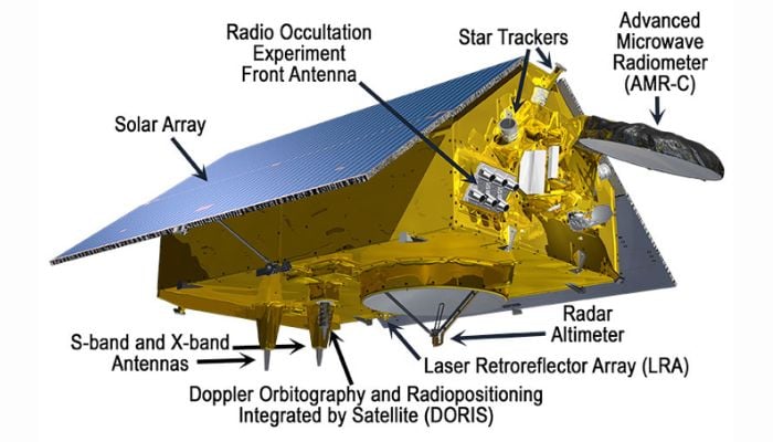
The Sentinel-6B spacecraft is a partnership of NASA, ESA, European Organisation for the Exploitation of Meteorological Satellites (EUMETSAT) and National Oceanic and Atmospheric Administration (NOAA).
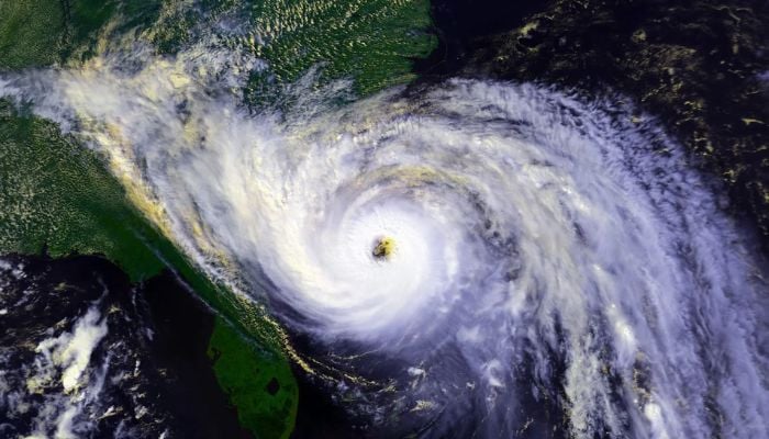
The shuttle is capable of tracking ocean heat and movement to enhance estimation of hurricane intensity and rapid intensification events. This data is crucial as extreme storms are increasingly threatening coastal communities.
How will it work?
The satellite perpetuates a 30-year-old legacy of transatlantic sea level monitoring with its twin, Sentinel-6 Michael Freilich, operational since November 2020.
“Sentinel-6 will track global changes in Earth’s ocean — height, heat, and movement — and will improve forecasts of local extremes like floods and hurricanes, linking planetary trends to real-world risks for communities,” said Nadya Vinogradova Shiffer, Sentinel-6 program scientist at NASA Headquarters in Washington.
The spacecraft will measure the slightest changes in the ocean heights, which usually occur when water expands as it gets warm.
With these track changes, scientists can identify deep pools of warm water that fuel hurricanes. Josh Willis, NASA’s project scientist said: “A tall column of warm water is like rocket fuel for storm.”
The data will feed both traditional forecast models and AI systems that can further forecast rapid intensification when wind speed surges by 35+ mph in 24 hours as seen in 2024’s catastrophic Hurricane Milton.
How is it beneficial?
The timely forecasts will ensure prompt disaster management by giving communities enough time to evacuate or fortify infrastructure. As endorsed by University of Miami economist Renato Molina, this will potentially save billions in damages.
The traditional ocean sensors will provide localised data but advanced satellites like Sentinel-6B provide the big picture view needed to anticipate storm behaviour.
A former National Hurricane Centre specialist, Mark DeMaria, emphasized: “These measurements are irreplaceable.”
Global collaboration for local impact
Developed with contributions from France’s Centre National d’Etudes Spatiales (CNES) and equipped with NASA’s advanced radiometers and laser reflectors, Sentinel-6B will ensure the continuity of a dataset that has already halved forecast errors since the 1990s.
With the escalated risks of hurricanes due to climate change, the mission highlights how space technology can help safeguard lives.