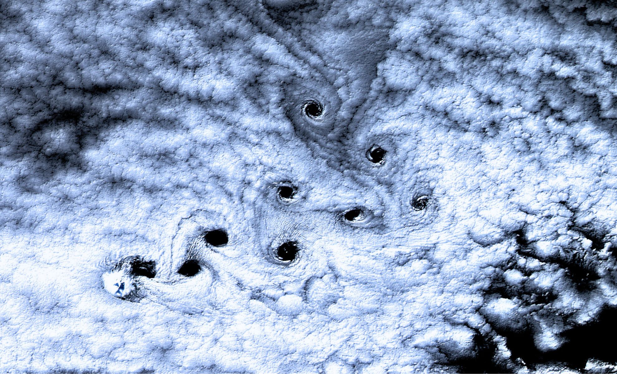
In a high-resolution satellite image taken by NASA’s Landsat 8 on May 3, 2016, a series of dark, swirling shapes appeared in the clouds above Heard Island, a remote volcanic island in the Southern Ocean. Located roughly 1,000 kilometers north of Antarctica, this uninhabited landmass became the center of attention after the release of the image revealed what looked like symmetrical “holes” punched through a thick blanket of clouds.
These patterns weren’t the result of anything artificial. They were von Kármán vortices, a naturally occurring atmospheric structure that forms when steady winds pass over large obstacles—like Heard Island’s towering Mawson Peak, a 2,745-meter active volcano. The interaction between the strong oceanic winds—known as the Furious Fifties—and the peak disrupted the air flow just enough to cause a chain of rotating eddies. NASA’s Earth Observatory noted that “the alternating vortices trail downwind in a sequence that reflects the laws of fluid dynamics.”
Why These Cloud Spirals Are So Visually Intense
Von Kármán vortex streets have been spotted before, but the chain above Heard Island stood out for several reasons. Most notably, the clarity and contrast of the spirals made them look like holes rather than subtle swirls. This effect was amplified by a thick and uniform cloud layer, which offered a proper background for the phenomenon to develop. Where each vortex rotated, it thinned the cloud cover—sometimes clearing it entirely—creating a dark, eye-shaped pattern that satellite sensors picked up in stark contrast.
NASA scientists highlighted how lighting conditions added to the sharpness of the image. The angle of sunlight during the early-May Southern Hemisphere autumn cast shadows that deepened the apparent darkness of the cleared zones. In essence, the vortices didn’t just disturb the clouds—they temporarily erased them.
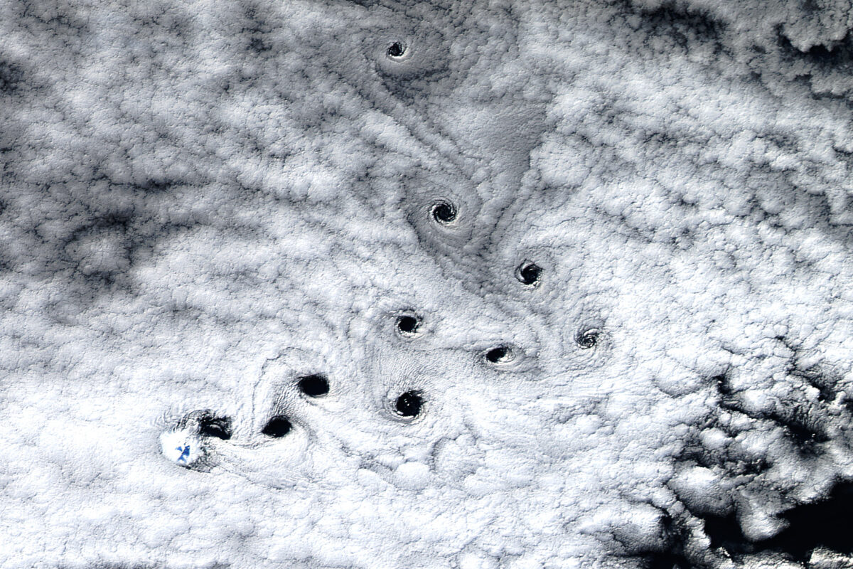
Adding an extra layer of visual complexity, the vortex chain in the image makes a noticeable 90-degree turn midway through. Atmospheric scientists believe this bend may have been caused by changes in wind direction or speed at different altitudes, subtly redirecting the airflow while preserving the vortex pattern.
A Hotspot for Atmospheric Anomalies
Heard Island’s extreme isolation and elevation make it an ideal location for observing undisturbed meteorological phenomena. The island acts as a natural laboratory for studying how terrain interacts with oceanic and atmospheric forces. With no human activity or pollution to skew the data, satellite imagery from this region often yields some of the clearest examples of atmospheric behavior.
The presence of Mawson Peak is critical. Rising steeply from sea level, the volcano consistently shapes airflow in the region. When strong westerly winds rush across its summit, they generate patterns that would otherwise be broken up over more populated or uneven landscapes. This uninterrupted vortex formation has turned Heard Island into one of the most visually dynamic vortex generators visible from space.
These Cloud Trails Help Scientists Read the Wind
Beyond the visual spectacle, von Kármán vortex streets carry important implications for climate and weather research. Their shape and spacing provide clues about wind speed, atmospheric pressure, and turbulence. Meteorologists and climate scientists use these formations to better understand how air flows around obstacles, especially in the remote Southern Hemisphere, where ground-based measurements are limited.
As NASA explains, studying vortices like those above Heard Island can help validate global circulation models used to predict long-term weather and climate trends. They also help refine satellite-based wind estimation algorithms, offering more precise data for use in everything from aviation safety to seasonal forecasting.