A striking view of the partial solar eclipse that happened on September 21 was caught not just by photographers on Earth, but also by the National Oceanic and Atmospheric Administration’s (NOAA) GOES-19 satellite orbiting high above.
The images, highlighted in a post on X, show how satellites continue to give irreplaceable perspectives on familiar wonders.
What is it?
The GOES-19 satellite (also known as GOES-EAST) is part of NOAA’s GOES-R series of environmental monitoring satellites. It was launched in June 2024 by SpaceX aboard a Falcon Heavy and became fully operational in April 2025 when it replaced GOES-16.
The satellite works in tandem with GOES-18 to scan half of the globe, continuously monitoring weather, environmental hazards, oceanic conditions and notably solar and space weather phenomena.
Where is it?
The GOES-19 is around 22,236 miles (35,880 km) above Earth’s equator in a fixed position relative to Earth’s surface.
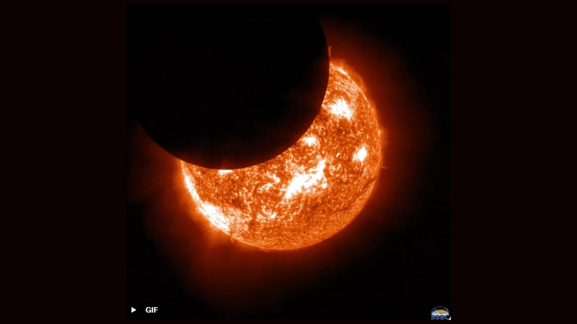
Why is it amazing?
While monitoring for space weather, the GOES-19 satellite captured this image of the partial solar eclipse that happened mid-September 2025. To capture this image, the satellite used the Solar Ultraviolet Imager (SUVI) which is designed to observe the sun’s hot outer atmosphere, the corona. It captures full-disk solar images in multiple EUV wavelengths, which helps with detections of solar flares and other solar activity, but also captures unique phenomena like a solar eclipse.
Want to learn more?
You can read more about solar eclipses and other weather satellites.