From navigating on Google Maps to tracking a hurricane making landfall, we’ve gotten used to seeing our planet from space. In the 1960s, though, that vantage point was ground breaking. At the time, NASA was pioneering human spaceflight—and astronaut photography—that would change Earth observation forever.
The NASA Gemini Program was the second U.S. human spaceflight program, building on the legacy of Project Mercury. Gemini is often referred to as the “Bridge to the Moon,” as it tested equipment and mission procedures that were later employed in the legendary Apollo missions that landed the first humans on the moon. But Gemini has another key legacy: its astronaut photographs were part of the inspiration for the Landsat program.
The photographs sent back by Gemini astronauts showed never-before-seen views of Earth that captured the minds of scientists and citizens alike. William Pecora, then-director of the U.S. Geological Survey, was so inspired that he proposed a new satellite program to monitor Earth from space. The USGS worked alongside NASA to launch the Earth Resources Technology Satellite in 1972. This satellite was later renamed Landsat 1, kicking off the longest continuous satellite record of Earth’s land surface.
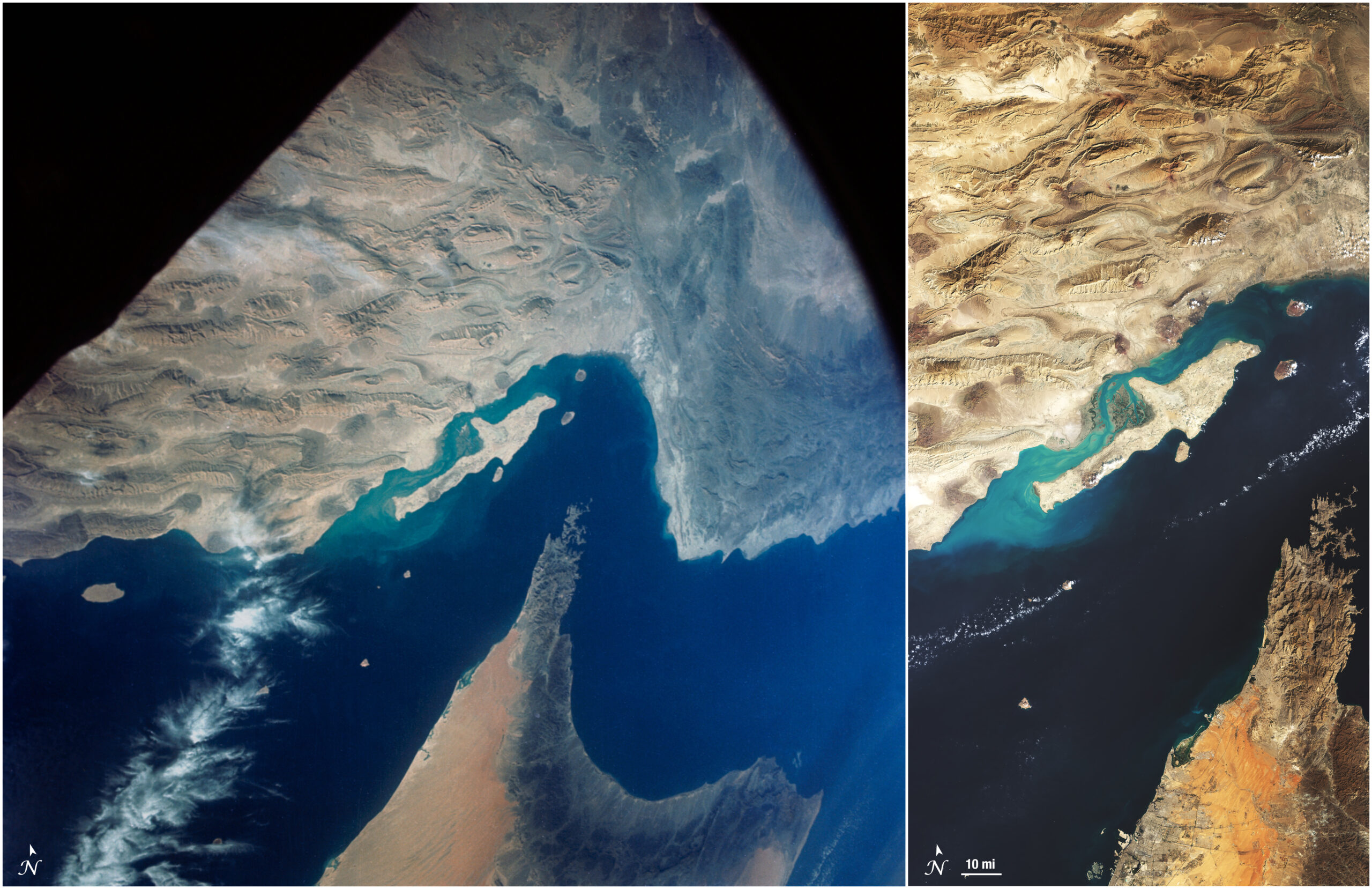
The photograph on the left was taken by an astronaut on NASA’s Gemini XII mission on November 15, 1966. The photo is centered on the Strait of Hormuz, which connects the Persian Gulf to the Gulf of Oman. The peninsula on the lower half of the image is the northern end of the Hajar Range on the Arabian Peninsula, while the folded land on the top half of the image are the mountains of the Makran Range in Iran. Many scientists immediately recognized that this kind of high-altitude imagery could be useful for geological research.
The image on the right was acquired by Landsat 8 on November 21, 2024. In the nearly 60 years since the Gemini photo was taken, much has changed in the region and in Earth observation. Landsat 8, launched in 2013, collects images at 30-meter spatial resolution, revealing much finer detail than the 1966 Gemini image. To the bottom left of the peninsula, which includes parts of Oman and the United Arab Emirates, the newly constructed World Islands are visible as a collection of dots off the coast. Dubai has also expanded rapidly, with the city sprawling to the right and land built from dredged sand on the left.
Hundreds of color photos were captured during Gemini missions and are now available online. This compendium of photographs provided a compelling argument for the need of space-based land observations that is still impressive to this day.
