In a world covered with sensors and satellites, access to high-quality data that can help solve problems and improve systems is more widespread than ever. But, with such a wealth of information at our disposal, how do we know we’re choosing the right data – and using it correctly?
Researchers from the University of Arizona explored that question in the realm of flood insurance, and their findings could have implications for disaster response and recovery.
In a study recently published in the journal Earth’s Future, the researchers use a simulated flood insurance program in Bangladesh to compare real-world flood datasets gathered from five different sources. The team found that the type of data used affects not only the accuracy and speed of payouts but also the level of certainty in anticipating future insurance payouts, which directly influences program costs.
Alex Saunders, the paper’s lead author and a Ph.D. candidate in the U of A School of Geography, Development & Environment, worked alongside Kevin Anchukaitis, director of the Laboratory of Tree-Ring Research and professor of Earth systems geography; Andrew Bennett, assistant professor of hydrology and atmospheric sciences; Beth Tellman, former assistant professor; and Jonathan Giezendanner, a former research associate, both in the School of Geography, Development & Environment. The team also included researchers from Virginia Tech, the Bangladesh University of Engineering and Technology and the Bangladesh Water Development Board.
Saunders believes their findings could benefit residents in flood-prone areas around the world by highlighting to insurance providers how selecting the most appropriate data from a wide range of options can improve disaster response and financial protection.
“More and more floods are happening every year, and that brings with it an increase in the total damage they cause,” he said. “In the case of insurance, creating a more accurate tool that helps people receive more timely payouts could help them get through some of the worst times of their lives.”
Governments, nonprofits and industries like agriculture, insurance and energy increasingly rely on Earth observational data: information gathered from satellites, aircraft and ground-based sensors that monitor the planet. Experts use this data to guide sustainable resource management, predict environmental change and respond to natural disasters.
In the case of flood insurance, companies increasingly rely on proxies – indirect indicators of damage, such as rainfall levels or river height – rather than directly assessing damage in insurance claims, which can be costly in both fees and the time it takes. These proxies are combined into indices, numerical thresholds that trigger payouts once crossed. Despite their growing use, Saunders noted that fundamental aspects of this system, such as which data sources are included in the insurance indices, often lack comprehensive testing.
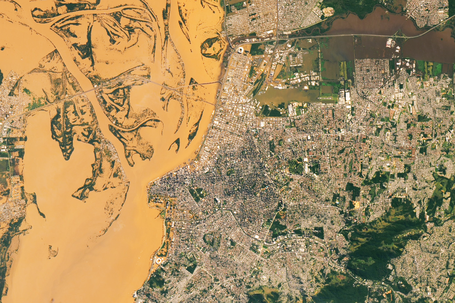
To address that issue, Saunders and his colleagues studied Bangladesh’s monsoon seasons between 2004 and 2023. They analyzed rainfall data, river levels and flood maps from the national flood agency, along with two types of satellite data that measure water coverage. One satellite method used traditional surface water readings, while the other relied on an artificial intelligence model designed specifically to track monsoon flood patterns in Bangladesh. The AI-powered model successfully captured the progression of flood waters, while the traditional satellite method delivered unreliable estimates when there was a high level of cloud cover.
The researchers then tested the five methods by evaluating when insurance was triggered over the 20-year period, how quickly those payouts occurred and how predictable they were.
Their analysis revealed that no single dataset consistently outperformed the others, though data choice did impact outcomes. In some cases, different indices disagreed on whether, or when, payouts should occur. These discrepancies were even more pronounced at the regional level, where local variations made certain datasets less reliable. Combining or comparing multiple sources also improved confidence in payout decisions.
“A stream gauge can tell us how high a river is, but that doesn’t automatically mean there’s flooding – or that people are nearby and at risk,” Saunders said. “Satellites can show the surface of a whole region, but rainfall data can be just as useful, even though rain doesn’t always lead to floods if the water flows somewhere else. That’s why it can take multiple datasets to really understand floods.”
Saunders added that one of the study’s most interesting results came from the AI-powered satellite model thanks to its ability to detect floods even during persistent cloud cover. Compared with the traditional satellite method the researchers tested, the AI approach triggered payouts an average of one week earlier. The newer approach also reduced the uncertainty in anticipated payouts by more than 20 percent, lowering potential insurance costs to customers.
Saunders recommends that index-based flood insurance programs test a wide range of data sources before implementation, incorporate multiple indices to reduce the risk of missed or unnecessary payouts, and explore new technologies like AI to improve accuracy and timeliness.
“Insurance providers may be guided in their decision making based on what data is most easily available, but there are a plethora of choices and more types of data through means like satellite sensors,” Saunders said. “But just because a specific data set is easily available or based on the newest technology, doesn’t mean it’s the right one for a given scenario. People should consider and compare the full range of available information to look for the best solutions.”
The need for more accurate insurance systems is urgent. Between 2000 and 2023, only 16% of the $1.77 trillion in global economic flood losses were insured, leaving governments, businesses and households to absorb the overwhelming majority of costs. Insurance and reinsurance – the practice of insurers transferring risk to other insurers – depend on accurate and timely information to support effective relief and recovery in communities impacted by flooding
By utilizing different sources of Earth observational data, Saunders said that governments, insurers and other organizations could have critical insight with which to make important, life-altering decisions – as long as they use that data wisely.