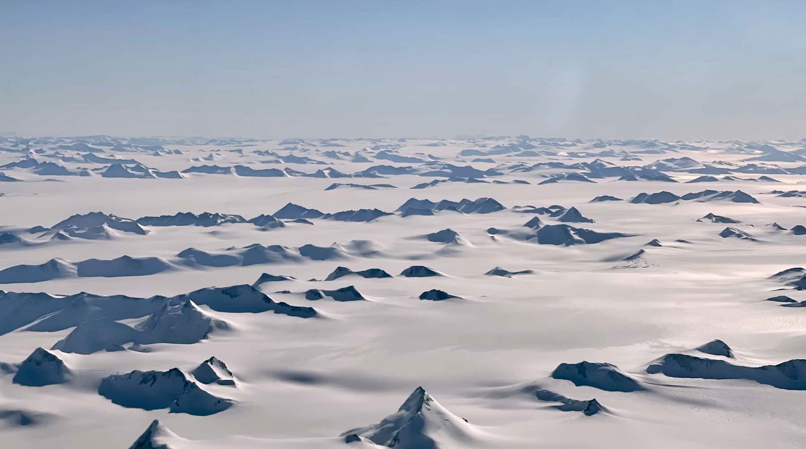
Durham University scientists examining radar images of the ice sheet above the east coast of Antarctica have discovered an 80-million-year-old ancient landscape hidden beneath the ice that is filled with mysterious flat surfaces. The scientists suggested this hidden array of flat surfaces was preserved by the ice sheet rather than eroded over the millions of years since.
The research team also found evidence that the ancient landscape of flat surfaces is directly affecting the flow of melting ice on the continent. They suggest understanding this relationship and how rising global temperatures may influence it could improve efforts to predict and prepare for the consequences of melting Antarctic ice and rising sea levels.
‘Fragments of Evidence’ Hinted at Ancient Landscape Beneath Antarctica
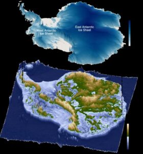
According to a statement announcing the discovery of an ancient landscape hidden beneath the ice of Eastern Antarctica, the entire continent originally separated from Australia around 80 million years ago. Around 34 million years ago, the once-green land mass became completely covered in ice. This ice sheet, combined with Antarctica’s extreme cold and remote location, has made studying the hidden ancient landscape underneath challenging.
Dr. Guy Paxman, a Royal Society University Research Fellow in the Department of Geography, Durham University and the lead author of the published study detailing the team’s discovery said this 80-million-year-old ancient landscape is so inaccessible, it is among the most mysterious “not just on Earth, but on any terrestrial planet in the solar system.”
Research co-author Professor Neil Ross, a Professor of Polar Science and Environmental Geophysics at Newcastle University, agreed. Still, the professor also noted that scientists have “long been intrigued and puzzled about fragments of evidence,” hinting at the presence of ‘flat’ landscapes hidden beneath the ice sheet covering this area.
Motivated to learn more, the researchers joined forces with researchers from Exeter University, UK, the British Antarctic Survey, the Alfred Wegener Institute, Germany, the Polar Research Institute of China, and Beijing University of Technology. Together, the team used detailed radar imagery of the 3,500-kilometer-long coastline between Princess Elizabeth Land and George V Land to essentially ‘peer through’ millions of years of ice to image the landscape below.
Paxman says the mysterious flat surfaces, which were found beneath roughly 40% of the examined area, immediately stood out from the rest of the hidden coastline.
“When we were examining the radar images of the sub-ice topography in this region, these remarkably flat surfaces started to pop out almost everywhere we looked,” the Durham University scientist recalled.
The research team suspects the flat surfaces likely formed over 80 million years ago during the separation from Australia and were ultimately preserved in almost pristine condition by the ice sheet. Dr. Paxman said the fact that the features managed to survive seemingly intact for the past 34 million years indicates that at least some parts of the ice sheet have “preserved rather than eroded” the landscape beneath. The team believes that preservation may hint at a “lack of intense, selective erosion” of these identified areas throughout Antarctica’s glacial history.
Deep Troughs and Melting Ice
Perhaps the group’s most significant finding was the possible relationship between the newly discovered flat surfaces and the movement of the ice sheet on top of them. For example, the imaging revealed that the ice above the flat surfaces moved significantly slower than the ice above other sections of the nearby ancient landscape.

The team also found that the flat surfaces were separated by “deep troughs” where ice moved significantly faster. They believe the flat surfaces may be steering these fast-moving glaciers into the troughs. Professor Ross explained that by bringing these “jigsaw pieces of data together,” his team was able to reveal “how these ancient surfaces formed, their role in determining the present-day flow of the ice, and their possible influence on how the East Antarctic Ice Sheet will evolve in a warming world.”
The team said it is possible the flat surfaces of this ancient landscape could be acting as “barriers to ice flow.” Because rising temperatures are causing Antarctica to lose ice at an increasing rate, the team said that understanding this potential regulation of Antarctic ice loss rate could be critical to climate prediction models, primarily since an entirely ice-free continent where all the surface ice has melted could raise global sea levels by 52 meters.
“Information such as the shape and geology of the newly mapped surfaces will help improve our understanding of how ice flows at the edge of East Antarctica.” Dr. Paxman said. “This, in turn, will help make it easier to predict how the East Antarctic Ice Sheet could affect sea levels under different levels of climate warming in the future.”
The team suggests that future efforts to better understand this hidden ancient landscape could include going to Antarctica and drilling through the ice sheet to retrieve samples of the mysterious surfaces. Combining this data with the team’s findings on ice flow would help improve the computer models used to predict the future effects of rising global temperatures and aid efforts to prepare for those effects.
Christopher Plain is a Science Fiction and Fantasy novelist and Head Science Writer at The Debrief. Follow and connect with him on X, learn about his books at plainfiction.com, or email him directly at christopher@thedebrief.org.