ISLAMABAD: Encroachment on the right of way of the nullah in Saidpur village may have caused the recent urban flooding that swept away three cars and several bikes, as Google images showed encroachments made during the last two decades.
Saidpur, the centuries-old village at the foot of the Margalla Hills, was once held up as a model of heritage preservation. In 2005, the government took a softer approach, offering a generous amnesty that allowed villagers to remain in place to help preserve the area’s cultural identity.
Capital Development Authority (CDA) officials said that in 2005, it was decided that there would be no expansion or new construction, and the village would stay within its existing footprint.
“Encroachments crept past the agreed boundary. Most damaging of all, structures appeared over the natural stormwater drain — Saidpur’s original flood outlet from the Margalla Hills. Now, this drain/nullah has been squeezed, which caused the recent flooding,” said an official of the CDA.
Google images show heavy encroachments made during last two decades
When contacted, Deputy Director General of Enforcement Syeda Anam Fatima said the civic agency had already conducted an operation in the said village and it would be expedited.
Asked about the Google images and construction on the right of way of the nullah, she said: “It’s important to revert the retrieved land into forest cover and to ensure natural watercourses remain clear of encroachments to prevent natural disasters.”
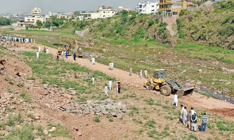
It is relevant to note here that not only the right of way of the said stream, but almost all natural streams in Islamabad have now become filthy nullahs. The right of way of one of the major nullahs of Islamabad — the Korang nullah, which comes from the Murree side and ends up in Rawal Dam — has also been encroached upon within Islamabad limits.
A general view of this nullah in the Bhara Kahu area shows massive construction on its alleged right of way, and there is a need for a proper survey to identify the exact level of encroachment.
The width of the nullah in the Satra Meel area, where the Bhara Kahu bypass ends, was also squeezed in recent years due to earth filling before carving out plots (Google images provide clear evidence). Similarly, all the way from Bhara Kahu to Bani Gala, there is massive construction that appears to be encroachment, and proper demarcation by the revenue department is needed.
Furthermore, there is also encroachment downstream of this nullah. After Rawal Dam, the extension of this nullah moves towards the Soan River, and there is huge construction along its length, which also needs proper demarcation.
Published in Dawn, July 24th, 2025