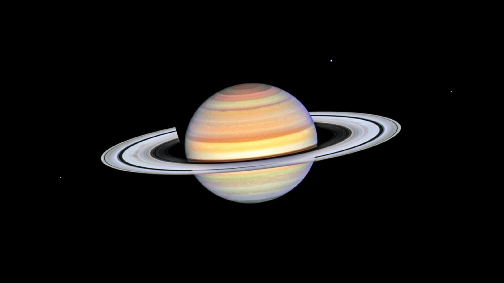
Ask anyone interested in the night sky what first got them hooked, and you’ll hear the same answer time and again — the sight of Saturn’s rings through a telescope. It may play second fiddle, but Jupiter’s cloud bands and Great Red Spot…
Category: 7. Science
-
New Study Warns: By 2100, Coral Reefs Could Be Overtaken by Algae – SciTechDaily
- New Study Warns: By 2100, Coral Reefs Could Be Overtaken by Algae SciTechDaily
- Mysterious volcanic gas bubbles give us a rare glimpse of the future New Atlas
- Ocean acidity is altering coral reefs and helping algae take over Earth.com
- Mass of…
Continue Reading
-
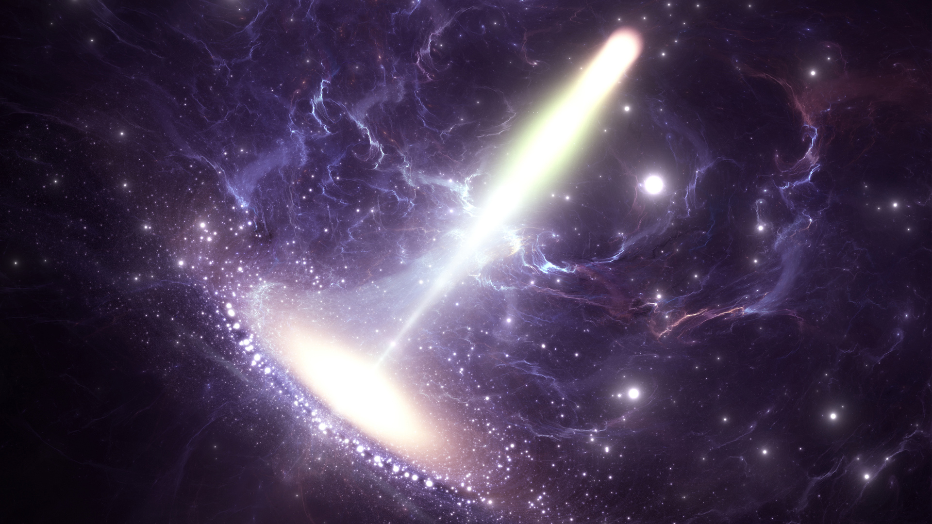
Dusty objects orbit safely around Milky Way’s giant black hole: Study
For years, the center of our galaxy has been painted as a place where stars go to meet their end — a region ruled by Sagittarius A*, a black hole so massive that its gravity can stretch, tear, and swallow anything that wanders too…
Continue Reading
-
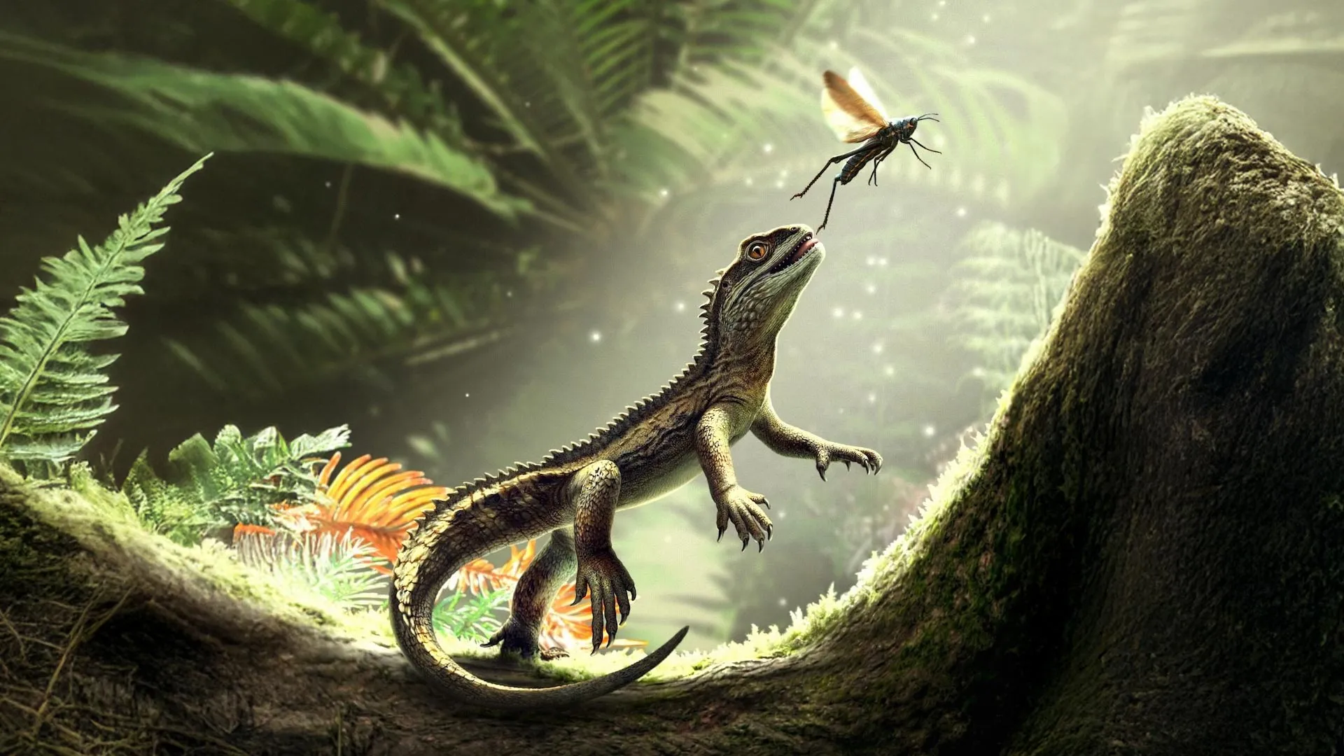
242-million-year-old mini predator changes lizard evolution
A recently analyzed fossil from Devon is giving scientists a rare look at what the earliest members of the lizard lineage may have looked like, and the findings come with several unexpected twists, according to researchers at the University of…
Continue Reading
-

The Sky Today on Sunday, November 30: Watch Titan reappear
Saturn’s large moon Titan reappears from an occultation behind the ringed planet early this evening, as smaller moons stand nearby.
This view shows…
Continue Reading
-
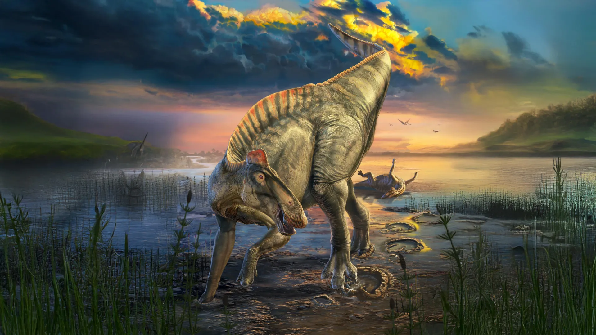
Dinosaur mummy found with hooves and a hidden crest
In a new paper in Science, researchers from the University of Chicago describe how, about 66 million years ago, the bodies of the duck-billed dinosaur Edmontosaurus annectens were transformed into remarkably detailed dinosaur “mummies” that…
Continue Reading
-
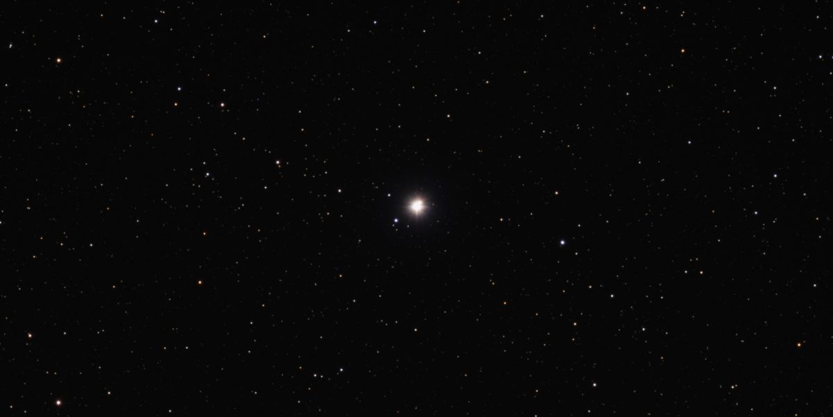
Astronomers focus on Eta Cassiopeiae after new data hint at life-friendly worlds
New orbital analyses suggest this binary star could support stable, Earth-like worlds that have gone undetected so far.
Others are reading now
Humanity…
Continue Reading
-

Insights into the occurrence, ecotoxicity, and biodegradation of perfluorooctanoic acid and perfluorooctanesulfonic acid in the marine environment
Researchers from Ocean University of China have conducted a review entitled “Insights into the occurrence, ecotoxicity, and biodegradation of perfluorooctanoic acid and perfluorooctanesulfonic acid in the marine…
Continue Reading
-
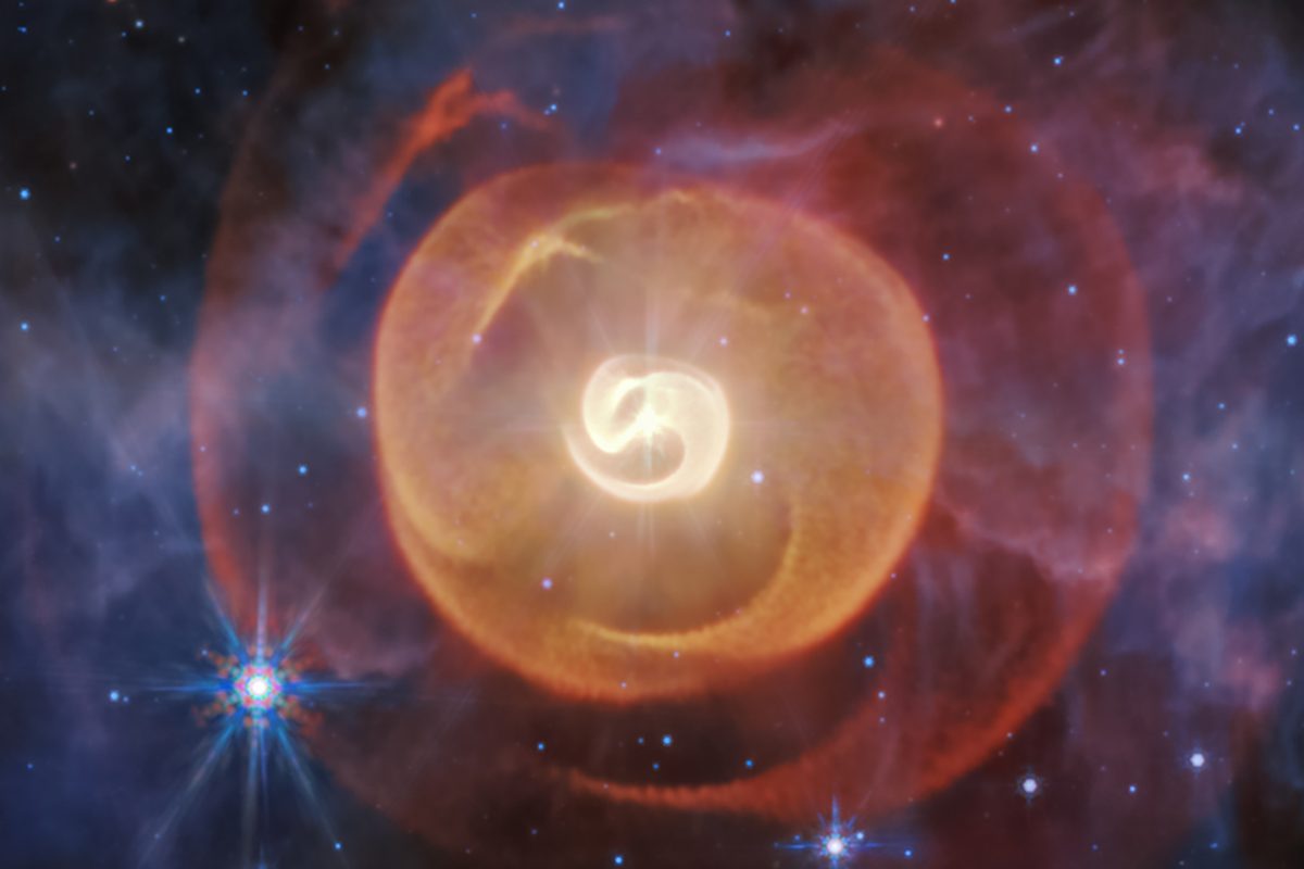
Webb Telescope sees strange dust spirals produced by a pair of rare stars, and gives astronomers a surprise
NASA’s James Webb Space Telescope has given astronomers a new view of a system of strange dust spirals in space generated by two ageing stars.
Webb’s infrared image captured an image of the four spirals of dust, revealing there’s more to this…
Continue Reading
-
Access Denied
Access Denied
You don’t have permission to access “http://indianexpress.com/article/technology/science/africa-heading-for-a-continental-breakup-researchers-predict-a-future-ocean-basin-in-the-next-5-to-10-million-years-10392893/” on this…
Continue Reading