
Jahed KR, Saini AK, Sherif SM. Coping with the cold: unveiling cryoprotectants, molecular signaling pathways, and strategies for cold stress resilience. Front Plant Sci. 2023;14:1246093. https://doi.org/10.3389/fpls.2023.1246093.
Category: 7. Science
-
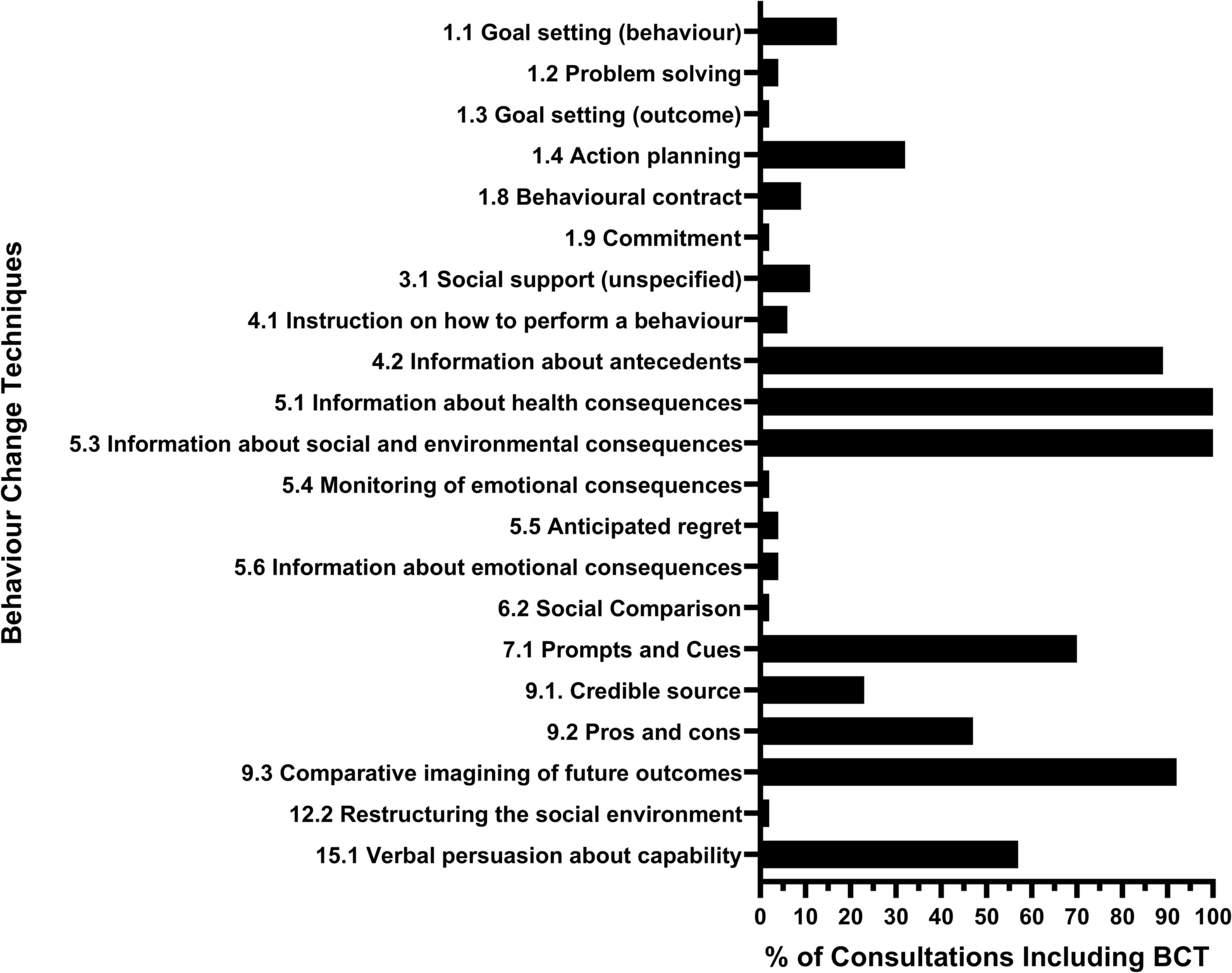
Shared decision-making and behaviour change collide: an analysis of consultations discussing clinical trial recruitment | Trials
This study has demonstrated the feasibility of applying the BCT taxonomy and OPTION5 tool to consultations in which clinical trials are discussed. The application of the BCT Taxonomy identified a range of BCTs implicitly applied by healthcare…
Continue Reading
-
Analytical characterization of optical solitons and bifurcation analysis for the (2+1)-D Wazwaz-Kaur Boussinesq equation
Mannaf, M. A. et al. Unveiling parametric effects on optical solitons of the Phi-4 model in mathematical physics. Partial Differential Equations in Applied Mathematics. 8, 100588 (2023).
Tahir…
Continue Reading
-
UN rights chief warns over generative AI
The UN on Monday warned that generative AI could become “a modern-day Frankenstein’s monster”, with human rights the first casualty, as powerful tech giants unleash the technology on the world.UN rights chief Volker Turk said generative AI had…
Continue Reading
-
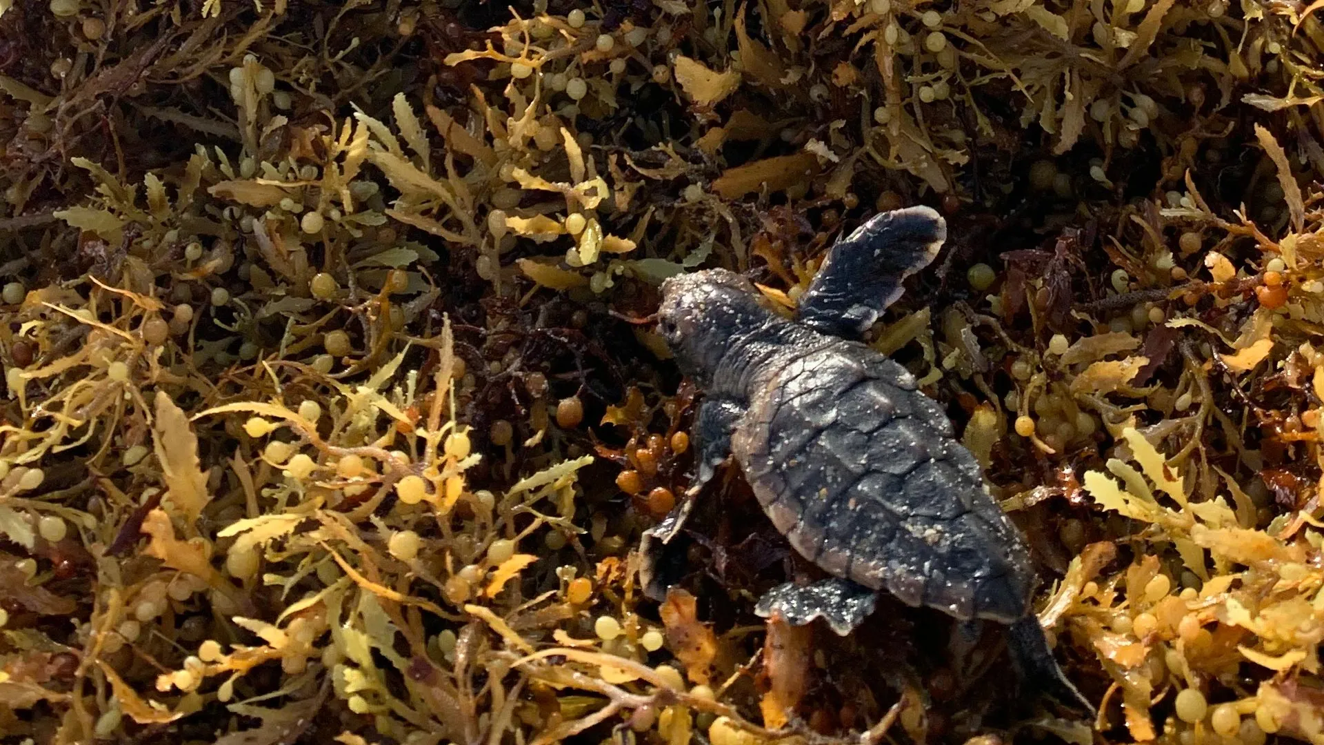
Record sargassum piles trap sea turtle hatchlings on Florida beaches
Every year, sea turtles emerge from nests on Florida’s beaches and begin the difficult crawl from the sand to the sea — a journey that plays a major role in whether they survive. Along the way, hatchlings must steer past artificial lighting,…
Continue Reading
-

“Far From A Pop-Science Relic”: Why “Six Degrees Of Separation” Rules The Modern World
Suppose you’re given a message to be delivered to a specific person as fast as possible. Here’s the problem, though: you don’t personally know the recipient; you don’t have their address, only a general location; and they’re far away…
Continue Reading
-
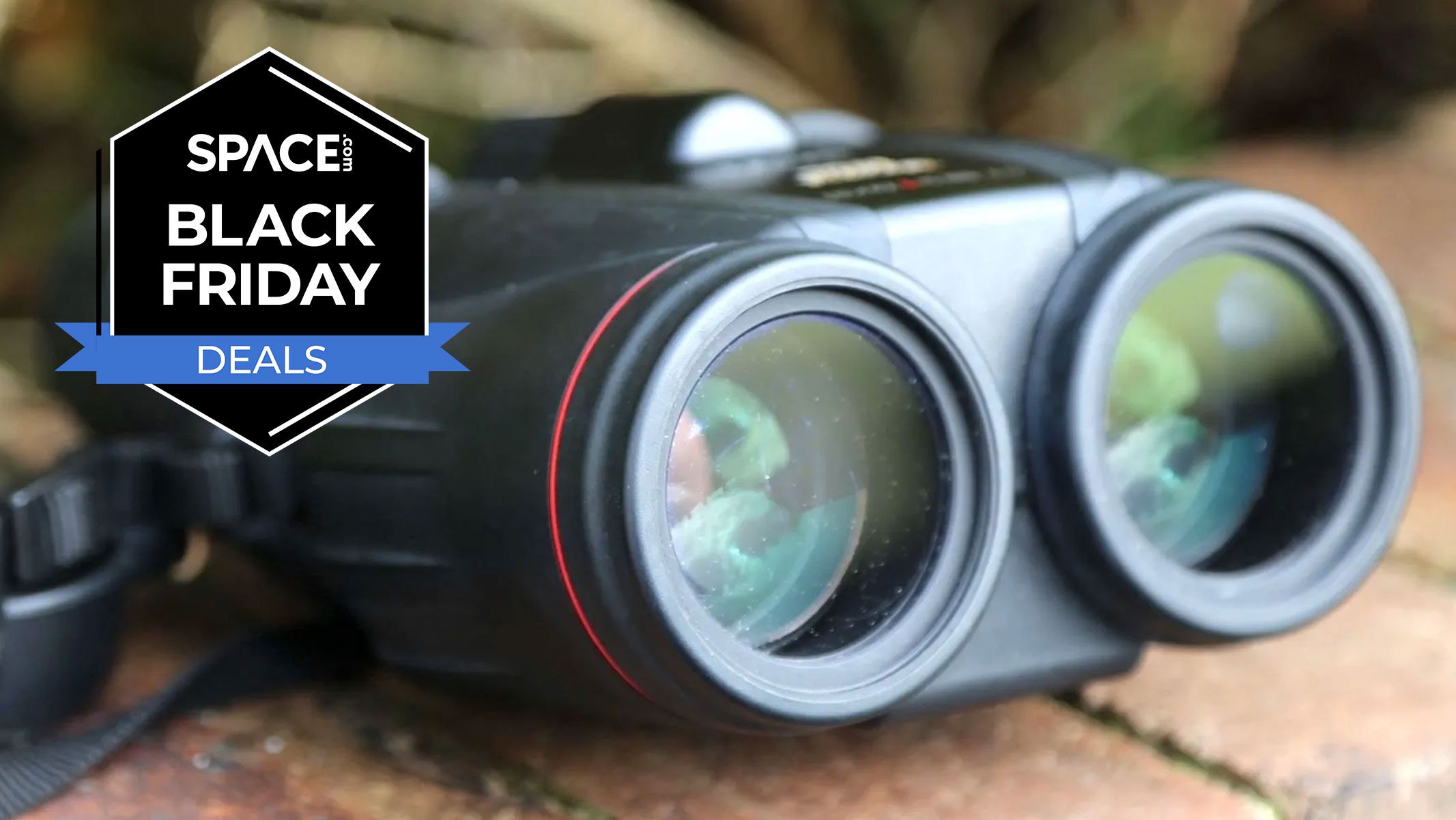
Rarely on offer! Canon’s IS binoculars are $324 off for Black Friday
Making it into our best binoculars and best binoculars for kids guides, the Canon 10x42L IS WP binoculars are a fantastic pair of binoculars, offering excellent optics, generous eye relief (for eyeglasses wearers) and image stabilization to keep…
Continue Reading
-

Was there ever a Yellowstone on Mars?
Yellowstone Caldera Chronicles is a weekly column written by scientists and collaborators of the Yellowstone Volcano Observatory. This week’s contribution is from R. Greg Vaughan, research scientist with the U.S. Geological Survey, and Steve…
Continue Reading
-

Unexpected ‘Zig-Zag’ Structures Discovered in Earth’s Magnetic Field : ScienceAlert
A strange phenomenon thought to only exist near the Sun has been detected in Earth’s magnetic field for the first time. The discovery could help scientists forecast the impact of geomagnetic storms more accurately.
Physicists Emily McDougall…
Continue Reading
-

Scientists want to search for life in this double star system devoid of giant exoplanets. Here’s why
A nearby binary star system is bereft of giant planets, but scientists think it may still be a decent place to look for life.
Binary star system Eta Cassiopeiae, located just 19 light-years away, could be a good target in the search for habitable…
Continue Reading