Qaasid News
Download Our App
Latest News from Pakistan
J&K Lieutenant Governor Manoj Sinha orders termination of five govt employees over terror links
January 13, 2026
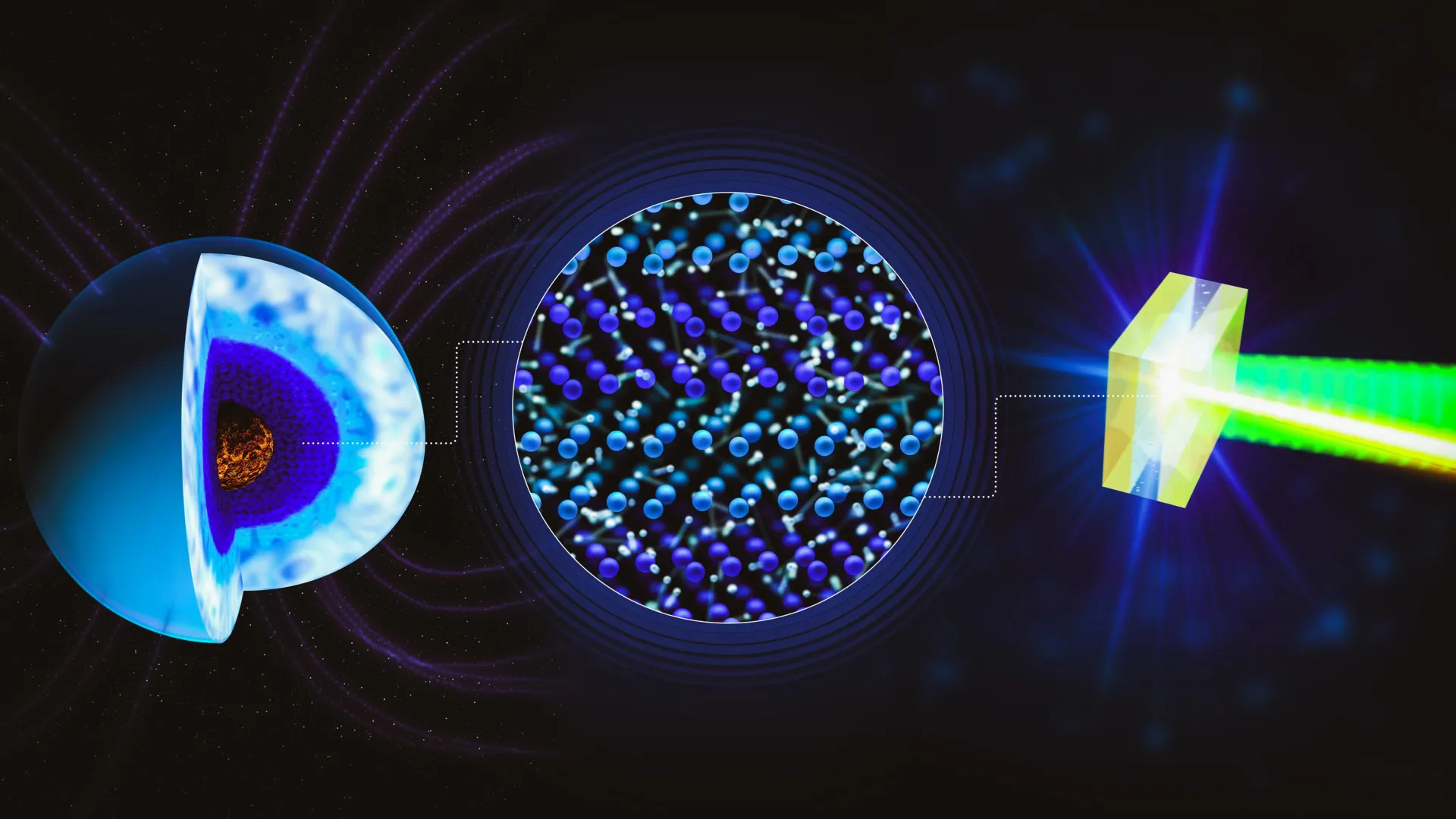
This strange form of water may power giant planets’ magnetic fields
January 13, 2026
Maple Leaf Foods Announces 2026 Financial Guidance and Dividend Increase
January 13, 2026
PTI violated commitments made in preparation for KP CM’s Sindh visit, says Sharjeel Memon – Dawn
January 13, 2026
HBO Sets January 19 Premiere for A Knight of the Seven Kingdoms – Northern Ireland Screen
January 13, 2026
Register now, with the ODPA
January 13, 2026
Material crisis for new connections in SNGC Lahore region intensifies
January 13, 2026
Jodar, Rodesch Facing One Another in Australian Open Qualifying
January 13, 2026
Punjab Govt to launch ‘Agriculture Lab on Wheels’ initiative for farmers – RADIO PAKISTAN
January 13, 2026
Earthquake jolts parts of country
January 13, 2026