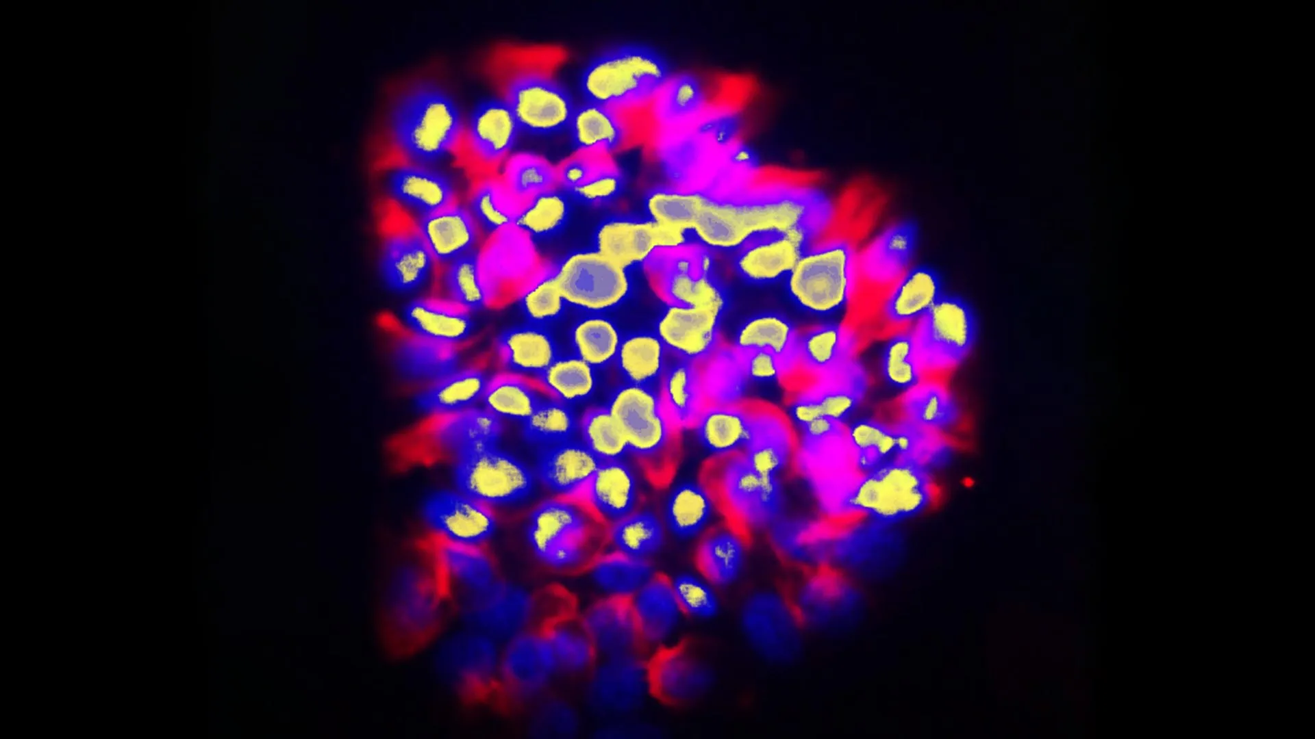
Why do some tumors spread while others remain localized? Scientists still do not fully understand what controls a cancer cell’s ability to metastasize, but answering this question is essential for improving patient care. Researchers at the…
Category: 7. Science
-
Harvard engineers build chip that can twist and control light in real time
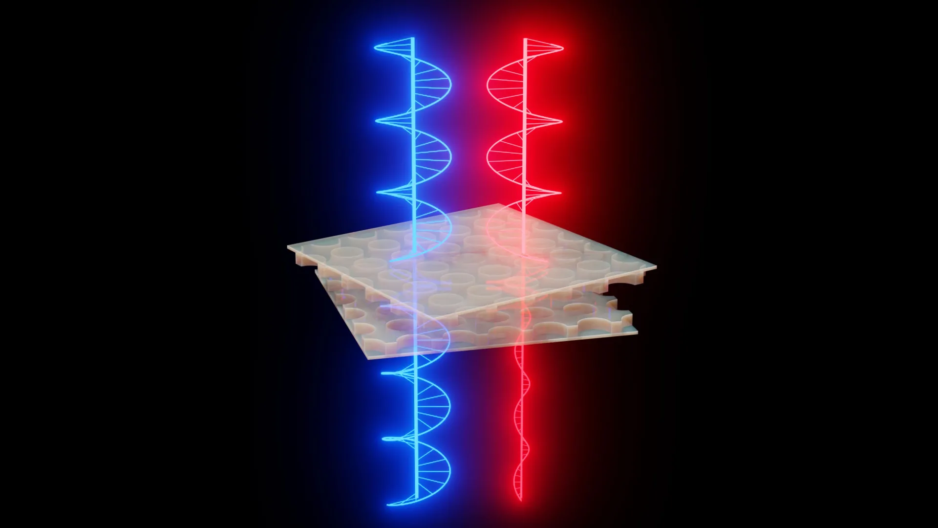
Researchers at the Harvard John A. Paulson School of Engineering and Applied Sciences (SEAS) have created a compact device that can actively control the “handedness” of light as it passes through it, also known as optical chirality. This is…
Continue Reading
-
“Shocking” Carbon Discovery in Sweden’s Forests Stuns Scientists – SciTechDaily
- “Shocking” Carbon Discovery in Sweden’s Forests Stuns Scientists SciTechDaily
- A ‘shocking’ carbon discovery in Sweden’s forests Stanford Doerr School of Sustainability
- Old-Growth Forests Store A Lot More Carbon Than Managed Forests
Continue Reading
-
Magnetic Fields Mapped in Star-Forming Molecular Clouds
Molecular clouds, which are dense areas of gas and dust, are the birthplace of stars. Gravity pulls on material, drawing it inward, but internal pressure counteracts this force, pushing it outward. Scientists have long theorized that a third…
Continue Reading
-

Global scientists reveal how farming affects soil via new Earth-sensing technology -Xinhua
BEIJING, March 21 (Xinhua) — A global research team has used a new technique to capture minute-scale structural changes in farmland soil, revealing how farming practices influence soil water dynamics.
The team, led by the Institute of Geology and…
Continue Reading
-

Why is NASA watching the Sun 24/7 before the Artemis II launch? Astronauts face invisible danger – The Times of India
- Why is NASA watching the Sun 24/7 before the Artemis II launch? Astronauts face invisible danger The Times of India
- Solar storms could endanger the Artemis II astronauts. Here’s how NASA plans to keep them safe BBC Sky at Night Magazine
- Here’s…
Continue Reading
-
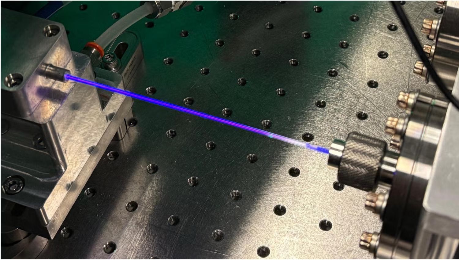
New Laser Could Transform Nanoelectronics and Nuclear Clocks
For decades, scientists have struggled to create lasers that operate in the vacuum ultraviolet region, a part of the spectrum with extremely short wavelengths between visible light and X-rays.
These wavelengths, typically around 100–200…
Continue Reading
-
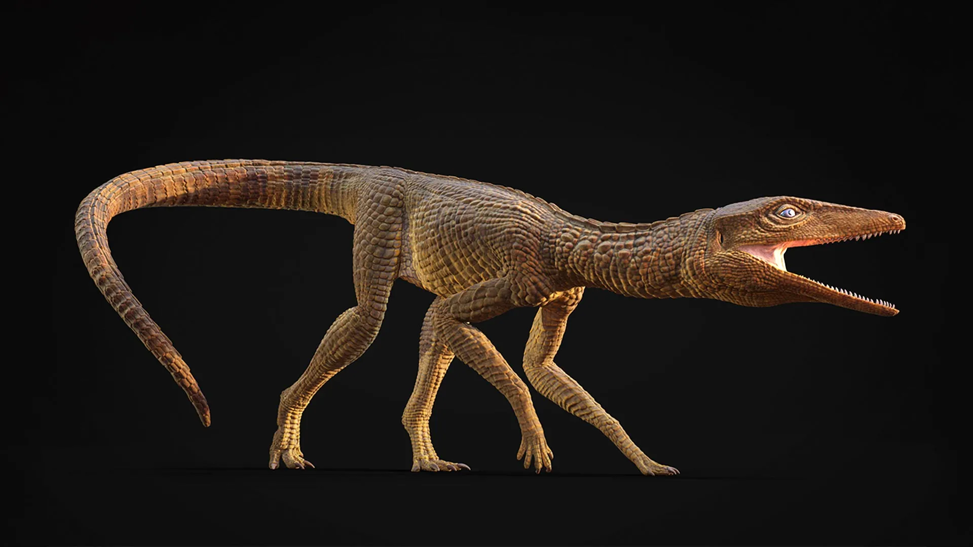
This crocodile ran like a greyhound across prehistoric Britain 200 million years ago
A newly identified crocodylomorph from about 215 million years ago has been discovered in Gloucester, UK, revealing a fast-moving, land-dwelling predator:
- The animal resembled a reptilian greyhound, with a slender build adapted for speed
- It…
Continue Reading
-
Atomic light could be most practical way to detect gravitational waves
Gravitational waves are usually hunted by measuring distance—how space itself stretches and shrinks ever so slightly. However, a new study takes a completely different route—don’t measure the ripple (the wave), watch what it does to…
Continue Reading
-
The Sky Today on Saturday, March 21: It’s Messier marathon night – Astronomy Magazine
- The Sky Today on Saturday, March 21: It’s Messier marathon night Astronomy Magazine
- Hubble’s Messier Marathon 2026 NASA Science (.gov)
- The astronomer who accidentally cataloged the universe Adirondack Daily Enterprise
- Custer Observatory to host…
Continue Reading